The Return of Ordnance Survey 1:50K
Those of you who use our GPS mapping application will have been disappointed before Christmas when we had to drop OS 1:50K map tiles from our mapping application and impose strict quotas on the use of OS 1:25K map tiles and aerial photography.
Many of you use the application to create GPX routes to load onto your GPS and also to display GPX tracks recorded on your GPS, or just to plan walks. Before Christmas, if you logged in, it showed you mapping at 1:50K scale using Ordnance Survey mapping tiles however since then you will have found that we had switched to using our OpenMaps tiles for 1:50K scale mapping and that only 1:25K scale still used Ordnance Survey mapping tiles.

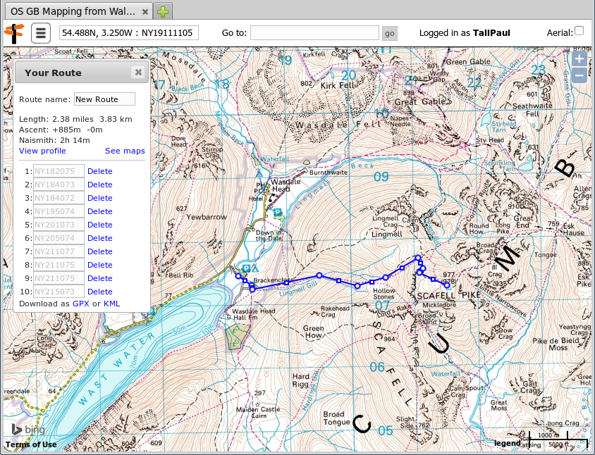
Ordnance Survey 1:50K mapping of Wasdale Head and Scafell Pike with a route planned
We had done this because a change in the way Bing charge for their mapping potentially made it a lot more expensive for us to offer you free mapping. In fact this didn't resolve the issue as Bing also supply our 1:25K map tiles and aerial photography so unless we could find a solution we would have to drop the 1:25K OS map tiles and aerial photography completely and offer only 1:50K OpenMaps tiles.
However some after discussion with Bing we are pleased to be able to announce that this has now been resolved and we are now able to restore 1:50K "Landranger" scale mapping and also increase your daily tile quota.
So, if you're wondering what all the fuss is about, here's a brief introduction to the application1.
You can find more, context sensitive, help on using the application by clicking on the menu button top left at any time and selecting 'Help'.
- Smart viewers may spot my mistake when discussing the track: Beth's times were being displayed in GMT but this was in July so you need to add one hour so she started at 5:50am, not 4:50am - still very early mind you.
You can comment on this post in our forum.
Participants in these activities should be aware of and accept these risks and be responsible for their own actions.