The Perils of Relying on a Smartphone
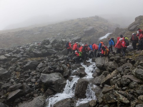
The Lake District mountain rescue teams rarely comment on the rescues they undertake but a recent 24 hour rescue lead by Wasdale MRT and involving over 70 rescuers, 5 search dogs and 2 drones has led them to comment in their report of the incident where the walker was relying on Google Maps to navigate.

Wasdale MRT said:
We rarely comment on a rescue, but in this case, we would like to say he was very, very fortunate to have survived his ordeal. We also have to say that Google Maps on smart phones are not suitable for navigating on the hills, they lack detail and of course will not work with a flat battery. There is no substitute for a map and compass and being able to use them.We can only agree. Even in perfect conditions Google Maps is really only good for navigating on roads and paths in town (and even there it's not great) but it's no use at all on the fells. There's really no substitute for a paper map. Its batteries don't run out. It won't break when you drop it. Sure, take a smartphone too - we certainly do - but don't rely on it.
If you don't have a printed map you can always print one yourself from our GPS mapping app or, if you're using one of our walks you can purchase the PDF of the walk and print that, which gives you maps of each section of the walk and directions.
Photo copyright Wasdale MRT.
You can comment on this post in our forum.
WalkLakes recognises that hill walking, or walking in the mountains, is an activity with a danger of personal injury or death.
Participants in these activities should be aware of and accept these risks and be responsible for their own actions.