A Christmas Present
When we're not out walking the Lakeland fells or hills elsewhere in the UK we're beavering away on the software we have on our site, in particular the GPX mapping app which has long had aerial photography available once you're registered and logged in.
We're now in the process of extending this so that you can view maps in 3D. So this means you will be able to plan walks and view the proposed route in 3D and then, when you've done the walk, you can upload the GPX track from your GPS to our site and view it in 3D from your browser without needing to install any additional software.
For example here's a screen shot of the application showing the track a walk Beth did from Kinlochleven to wild camp by a lochan below Binnein Beag.

And here is the same track overlaid on aerial photography which we think looks very cool indeed.
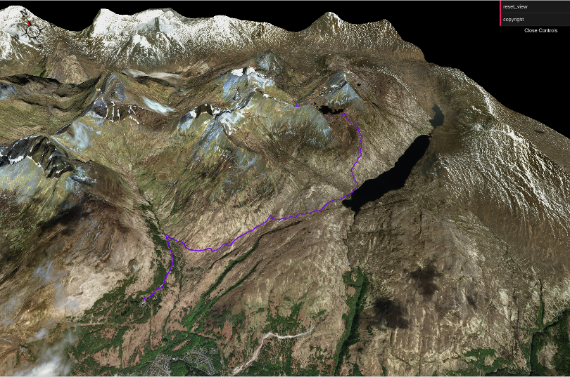
If you're using the web app these won't just be static images, you will be able to zoom in and out and rotate the map, much like Google Earth. We're currently testing this software, and supporters will be getting emailed about ways they can get involved later today.
We're intending to integrate this into our existing mapping application and also into our walks so you will be able to view any of our walks in 3D.
So our Christmas present for WalkLakes users is going to be a little late this year, but we think you're going to like it. A lot.
Tagged: maps
You can comment on this post in our forum.
Participants in these activities should be aware of and accept these risks and be responsible for their own actions.