New Path, New Crossing
You may remember that back in December we launched our WayMaps mapping tiles which are built from open data from a number of sources put together with our own styling.
We are aiming to update these tiles regularly to pick up all the changes in the sources we use, especially OpenStreetMap from whom we source all our paths, and today sees a new release of those tiles.
This release now includes for the first time the new Ullswater Way, a long distance path around Ullswater.

We are planning to survey this path and have it on our web site when we can, although the weather has not been kind to us lately.
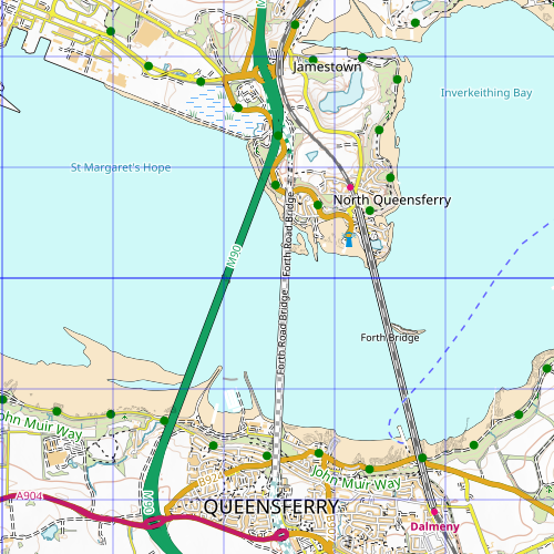
Meanwhile elsewhere in the UK the opening of the new Queensferry Crossing over the Firth of Forth at Edinburgh has left everyone who has online mapping keen to get their map tiles updated and that goes for us too. Here's the crossing at zoom 7.

All our walks have been updated to use these new map tiles and, if you have purchased any for printing or reading then offline then, if you download from your rucksack again, you will find they have been updated there too.
You can comment on this post in our forum.
Participants in these activities should be aware of and accept these risks and be responsible for their own actions.