New Release of our Maps
You may remember that back in December we launched our WayMaps mapping tiles which are built from open data from a number of sources put together with our own styling.
We are aiming to update these tiles regularly to pick up all the changes in the sources we use, especially OpenStreetMap from whom we source all our paths, and today sees a new release of those tiles.
As well as all the incremental changes from the underlying sources we've been tweaking the rendering of minor roads and tracks, which were previously being rendered both a little wide and also overly bold on the higher zoom levels.
For example here's a random grid square at zoom 9 (1:25,000) from the last release which illustrates this:
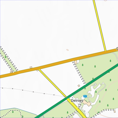
And here's how it looks now:

You will notice that the orange B road and the yellow minor roads are now narrower and so in proportion with the green trunk road and their "casings", the dark lines on their edges, are a lighter shade of grey. Similarly the tracks, which are shown with dashed casings, are now rendered in a lighter shade.
We think this improves the overall look of zoom levels 7 to 9 as well as freeing more space for displaying other map features but, as always, we welcome your feedback.
These tiles are live now on all our walks and the GPX mapping application. If you've purchased any walks from us as PDFs then we've also updated them in your rucksack if you want to download and print them again.
You can comment on this post in our forum.
Participants in these activities should be aware of and accept these risks and be responsible for their own actions.